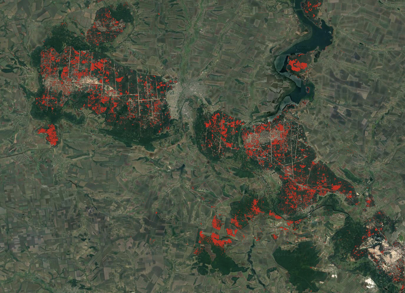
Due to the Russian full-scale military invasion of Ukraine in February 2022 a vast area in the southern and eastern parts of Ukraine came under massive shelling and has been impacted by a variety of war-related activities.
The forests have primarily been damaged by forest fires due to shelling-related ignition and mechanically damages to branches and stems.
“The scale of environmental damage to Ukrainian territory, caused by the Russian aggression, is massive, although its full extent currently remains unknown due to the ongoing war”, says Maksym Matsala researcher at SLU, the Swedish University of Agricultural Sciences.
Analyzed satellite imagery
Maksym Matsala and his colleagues used Sentinel satellite imagery to document significant increases of damages to the forests in three of the most impacted forested areas in Ukraine for the year 2022.
In the area of Kherson, along the Dnipro river delta, around 7 000 hectares, 16 per cent, of forest stands were damaged. In the other two areas of interest, the Chornobyl Exclusion Zone and the forests between the cities of Kharkiv and Luhansk, 5 and 9 per cent of the forest cover were damaged.
In the paper published Scientific Reports the researchers speculate that the fire hazard risk will be high in the coming decades. Due to unexploded ordnance contamination, many burned pine plantations remain un-salvaged with large accumulations of woody fuel. This will soon be supplemented by new grass that is highly flammable in dry period. In the dry Kherson area 89 percent of forest has an elevated fire hazard, and the elevated risk in the other areas of interest is 70 per cent.
“Fortunately, there were no major fire weather extremes in 2022 and 2023 in Ukraine. However, pre-war fire events suggest that extremely dry and windy weather, favoring megafires, will occur sooner or later”, says Maksym Matsala.
Need for new forest management
Restoration of damaged forests following a liberation of Ukraine may need to follow updated management policies, which will incorporate proactive management of fire risks. The even-aged plantations of Scots pine that are dominating the forestry have shown an increased risk of wildfires.
“Shifting the focus from commonly dense and highly flammable coniferous monocultures to a mosaic of more structurally diverse and less flammable forests could be a crucial element of this transition”, says Maksym Matsala.
“We speculate that recently fragmented forests could benefit from only partial regeneration of disturbed patches, with some of them being kept as fire breaks with low fuel loads. This should reduce fuel contiguity that facilitate rapid fire spread.”


